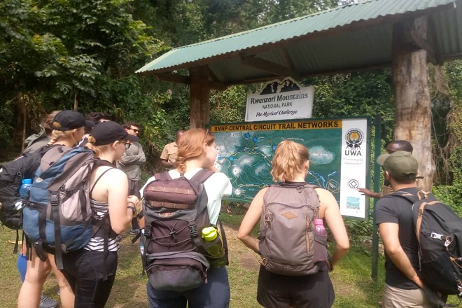
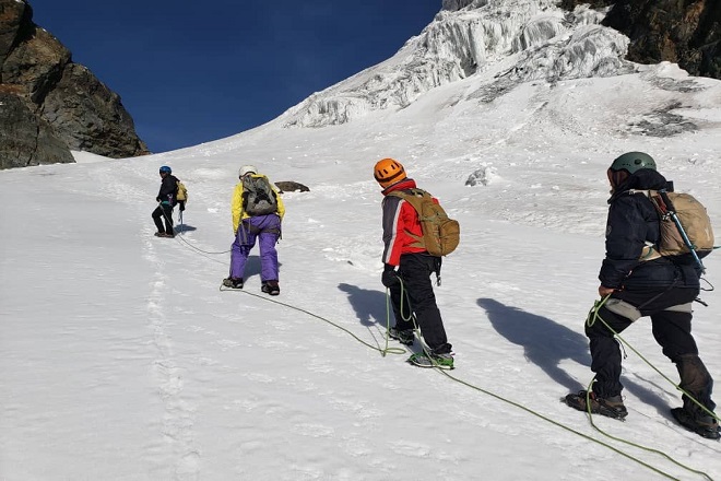
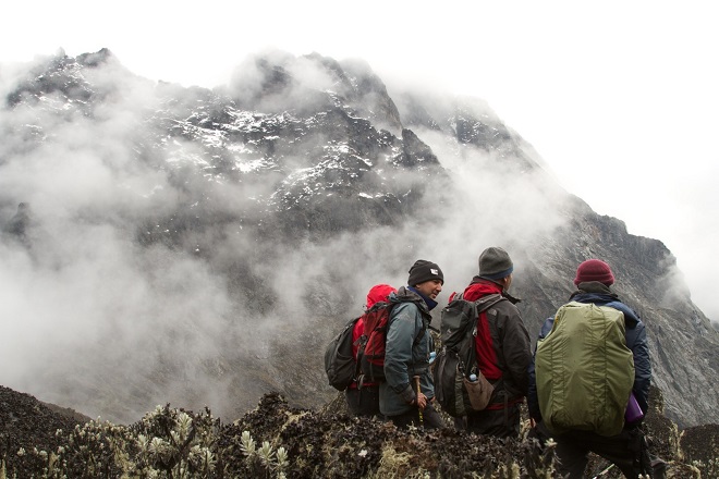
Photography trip to Rwenzori Mountains National Park is very possible on your visit to the Rwenzori mountains. Rwenzori mountains is a world heritage site and a UNESCO site that have got captivating features that your eyes can’t miss seeing them. From the lush green forests to the rocky/glacier zones of the mountain.
The Rwenzori mountains is trekked all year round but the best season for photography adventure is during the dry season from December to January and June to August, during this time there are little rains that clear the skies.
Why Book a photography trip to Rwenzori mountains National Park
While on your photography trip to Rwenzori mountains national park, you will not only take photos but immerse yourself in the raw beauty of the Rwenzori mountains. You will almost take a photo on everything you set your eyes on.
Rwenzori mountains comprise of 5 vegetation zones namely; montane forest zone, bamboo zone, heather/moorland zone, afro alpine zone and Rocky/glacier zone. Each vegetation zone has varying altitude level and unique flora and fauna, each zone gift you with wonders of nature.
Pick that big camera with a big lens on your journey to the Rwenzori mountains! Take the magnificent Rwenzori peaks that meet with clouds.
Birds like the malachite sunbirds waiting for shots on the lobelia walastoni plants, Rwenzori turaco birds jumping from one branch to another on the podocarpus trees.
You will be amazed with the Rwenzori colobus monkeys jumping on trees from one valley to another with their male dominant leading them with calling sounds after realizing you are watching them with a Pro camera.
Photography trip while trekking the Rwenzori is a rewarding adventure, testing your limits as you sight wonders of nature in the mystical Rwenzori mountains.
Best time for photography trip to Rwenzori mountains national park.
There are 2 best seasons of the year in which you can plan your photography trip to Rwenzori mountains national park.
The first season starts in the months of May, June, July and August then the second season starts in late November, December, January and February. This period Rwenzori experience little rains or no rain at all making the trails dry and easy for trekking.
Rwenzori trails where to take your photography trip.
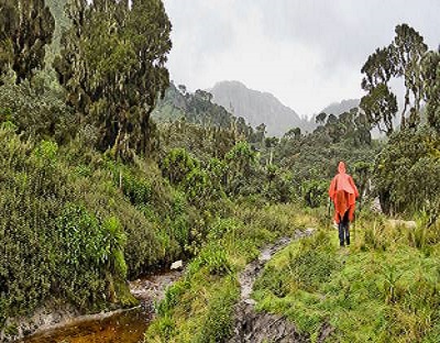
Photography trip to Rwenzori Mountains National Park.
The best 3 trails of the Rwenzori are the central circuit trail, kilembe trail and the new trending Bukurungu wilderness trail.
Detailed itinerary for photography trip to Rwenzori mountains national park.
Day 1: Nyakalengijo (1651m) to Nyabithaba Hut (2651m).
Your photography trip starts at the Rwenzori mountains national park Mihunga gate 1651m asl.
The driver guide will drive you to mihunga gate for briefing, meeting porters, chef and the guides. The trail begins passing through farmland to the park boundary beyond which it follows a thick forest along the mubuku river. Cross the mahoma river tributary before starting a long steep climb up onto a massive ridge to reach Nyabithaba hut.
During this part of the trail, you may hear chimpanzee and see black and white colobus monkeys, blue monkey and the brilliantly coloured Rwenzori turaco.
Hike duration: 4-5 hours.
Day 2: Nyabithaba Hut to John Matte Hut (3505m).
On your day 2 of the 7 days Rwenzori trekking Safari, you will begin climbing to John Matte Hut after your breakfast. this is believed to be the longest trials as it consumes minimum of seven hours on move.it involves passing through the forest for a short time before you cross Kurt Schefer bridge on river Bujuku. From here the trail to Nyamuleju Hut is very smooth and clear as it takes few hours although as you go far, the trail becomes more steeper as your entering higher grounds which is the place common for heather plants. you will proceed with the trial through massive heather forest and from the trail along River Bujuku, this will take roughly 3 hours and a distance of 200m to reach John Matte hut.
Dinner and overnight stay at John Matte Hut.
Hike duration: 7-8 hours
Day 3: Trek from John Matte to Bujuku Hut (3,962m).
After break fast in the morning, you start from John Matte to Bujuku hut. The trail leads down to cross the Bujuku River and arrive at Inferior Bigo Swamp, home of massive lobelias. Cross the swamp to the Higher Bigo swamp before proceeding to Lake Bujuku where sights of the uppermost mountain Stanley in the west are to be viewed.
Dinner and overnight stay at Bujuku Hut.
Hike duration: 4-5 hours.
Day 4: From Bujuku Hut to Elena Hut (4541m).
On this day, you trek through the groundsel vegetation along the 4km path, climbing up 4541m which is about 5-7 hours hike. You will ascend through the sides of the Upper Bigo bog, and later on follow the hike down through the steep slopes of Lake Bujuku to the West. Climb up to the 4372m Scott-Elliot pass, and later continue through several swamps and the remarkable ground gully. You will then walk through the steep section above the gully by a metal ladder reaching a junction with two divided trails, with the right trail leading to the Elena Hut rising through a steep trail above the large boulders to Mount Stanley while the left trail heads to the Scott-Elliot pass descending to Kitandara hut.
The trail is then divided into two. The two trails, the left trail leads to Scott-Elliot pass descending to Kitandara Lakes while the right trail heads to the Elena Hut and on a steep trail above large boulders to Mount Stanley.
Situated at the rocky part of Mount Stanley, Elena hut is located in a cold region, although it offers beautiful views of Mount Baker and Mount Speke, which is sometimes hard to see due to fog. Dinner and an overnight at the Elena hut.
Hike duration:4-5 hours.
Day 5: From Elena to Margherita to Kitandara hut.
Today, you will wake up as early as 2:00am, for breakfast, and embark on your hike to the top of Margherita peak, taking about 4-5 hours. You will hike through the Stanley plateau to Mount Stanley. Using ropes, you will hike through the sharp rocky regions, while the crampons as well as the ice axe will be used on the glacial axe- as directed by the guide. This will take a couple of hours, after which you will reach at the edge of Margherita glacier-the most challenging part of your Rwenzori trekking Safari. You will then proceed to the top of the peak of Mount Stanley (Margherita Peak-at 5109m).
At this point, enjoy the impressive views of Lake Ireen, Mount Speke and the surrounding, after then descend Elena hut for lunch and dinner.
Otherwise, you can proceed to Kitandara, through the Scott Elliot pass (also considered as the most beautiful spot of Rwenzori) dinner and an overnight at Kitandara hut.
Note That: However, depending on your group’s strength, you may opt to spend another night at Elena Hut, and continue the next day to Kitandara then to Guy Yeoman.
Hike duration: 3-4 hours.
Day 6: Kitandara hut (4023m) to Guy Yeoman Hut (3505m).
After breakfast, a sheer hike from the base of Mt Baker to the fresh field pass south parts of Rwenzori over the distance of 4280m. Outlook the Congo in the west and Mt Stanley in the north is very possible. From the trail, the boggy pass proceeds downhill, going through the rock housing at Bujongolo which is a historical excursion by the Duke of Abruzzi in 1906.
Dinner and overnight stay at Guy Yeoman Hut.
Time duration: 6-7 hours.
Day 7: From Guy Yeoman Hut to Nyakalengijo.
After your morning breakfast, you will start descending back to Nyabithaba Hut; this will take around six hours depending on the pace to reach the Hut. The trek goes past the nearby Lake Mahoma and Nyabithaba and passes through the heather area and the Moss Zone. This is the final day in the Rwenzori Mountains. Overnight in Kasese.
Contact us today and we organize your photography trip to the Rwenzori mountains.